The cement industry is working intensively on measures to reduce its process-related CO2 emissions. In Switzerland, cement production was responsible for 5.3% (4.2 million t CO2-eq) of the total Swiss CO2 emissions in 2019. Currently, cement production generates between 500 and 700 kg of CO2 per tonne of cement produced (around 1/3 from the fuels used to fire the cement kiln and 2/3 from the chemical reaction (calcination) used to create the clinker).
Many companies have set themselves the goal of reducing CO2 emissions through a number of direct and indirect measures. These include the production of low-clinker cements or the replacement of part of the clinker with reactive/calcined clays. With the LC3 process (LC3 = Limestone Calcined Clay Cement) developed by EPFL with the support of the Swiss Confederation, for example, a cement mixture is to be produced that consists of only 50% clinker (today: 65 to 80%). The remaining part consists of about 30% calcined clay, 15% limestone and 5% gypsum. The calcination of clay requires a lower temperature than that of limestone (800°C instead of 1450°C) and does not produce geogenic CO2 emissions.
Cement is produced in Switzerland in six cement plants. At all these sites, locally occurring limestones, marls and sometimes clays are processed to produce cement. To estimate the national potential of substituting clinker by calcined clays, it is key to understand, if and where suitable clays are available in the vicinity of the cement plants.
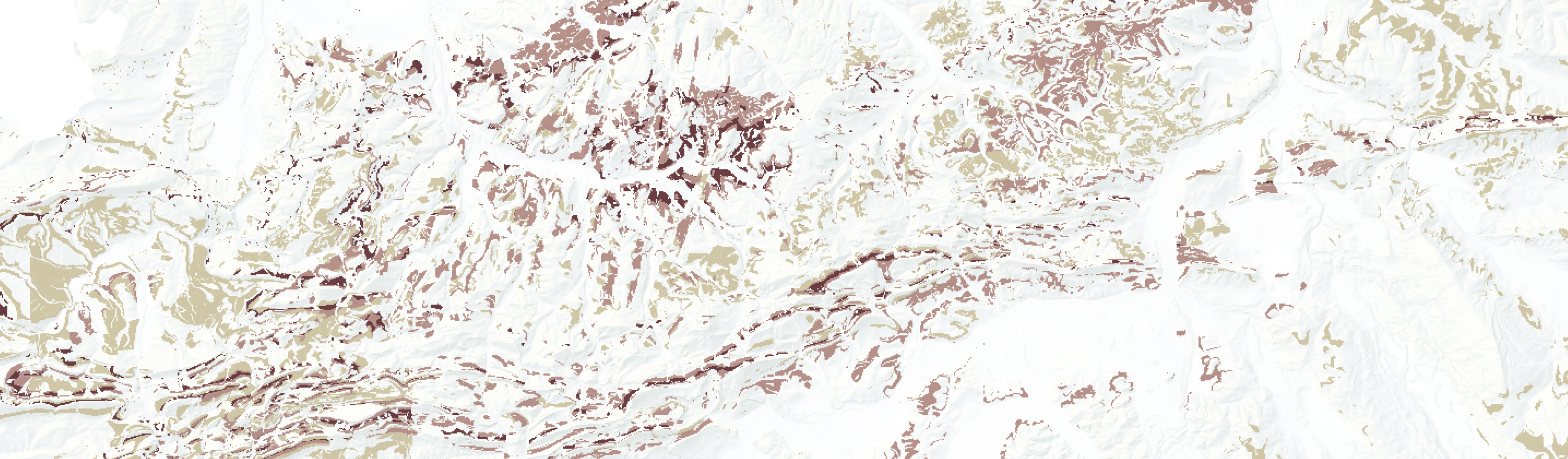
Our study thus aims at producing an overview of the clay-rich geological units in Switzerland within a 50 km radius around the cement production sites and below a ground elevation of 1300 m a.s.l. Based on the publicly available GeoCover dataset and on an extensive review of the stratigraphy and available literature, the area of interest is investigated at a scale of 1:25’000 to locate clay-bearing units and systematically estimate their clay content. As the geological map data do not quantitatively specify the clay content, we have developed a quantification scheme to approximate the clay content from the lithological descriptions of the geological units. Only the bedrock units were assessed. In the absence of sufficiently dense and systematically attributed borehole and GeoCover data and given the high degree of geological complexity, the unconsolidated deposits were not yet evaluated.
The resulting clay indication map (published soon) will show the spatial distribution of the units that are likely to contain clay-rich lithologies.
In order to confirm our findings and to better constrain rock types and areas with geological units having the most promising clay (i.e. kaolinite) content, we are planning to conduct a field assessment, including sampling and laboratory analysis, of the key clay-rich formations identified.