The Swiss Federal Office of Energy (SFOE) and the Federal Office of Topography (swisstopo) are promoting geothermal exploration as part of the Energy Strategy 2050. During the prospection and exploration phases of geothermal projects, various geoscientific data are produced, which are stored by swisstopo (Swiss Geological Survey) and made available to the public. In this context, we developed methods and algorithms for the (semi-) automatic acquisition, analysis and evaluation of geological and geophysical data sets in our project (2019-2022).
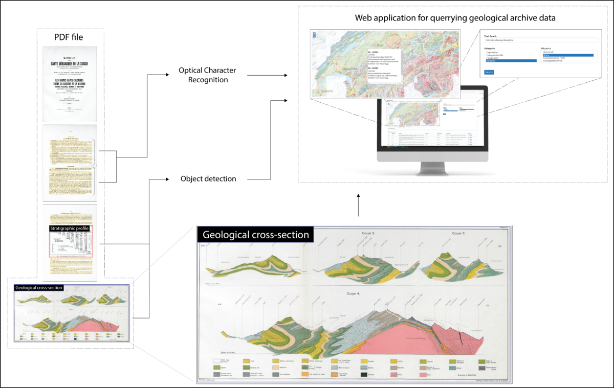
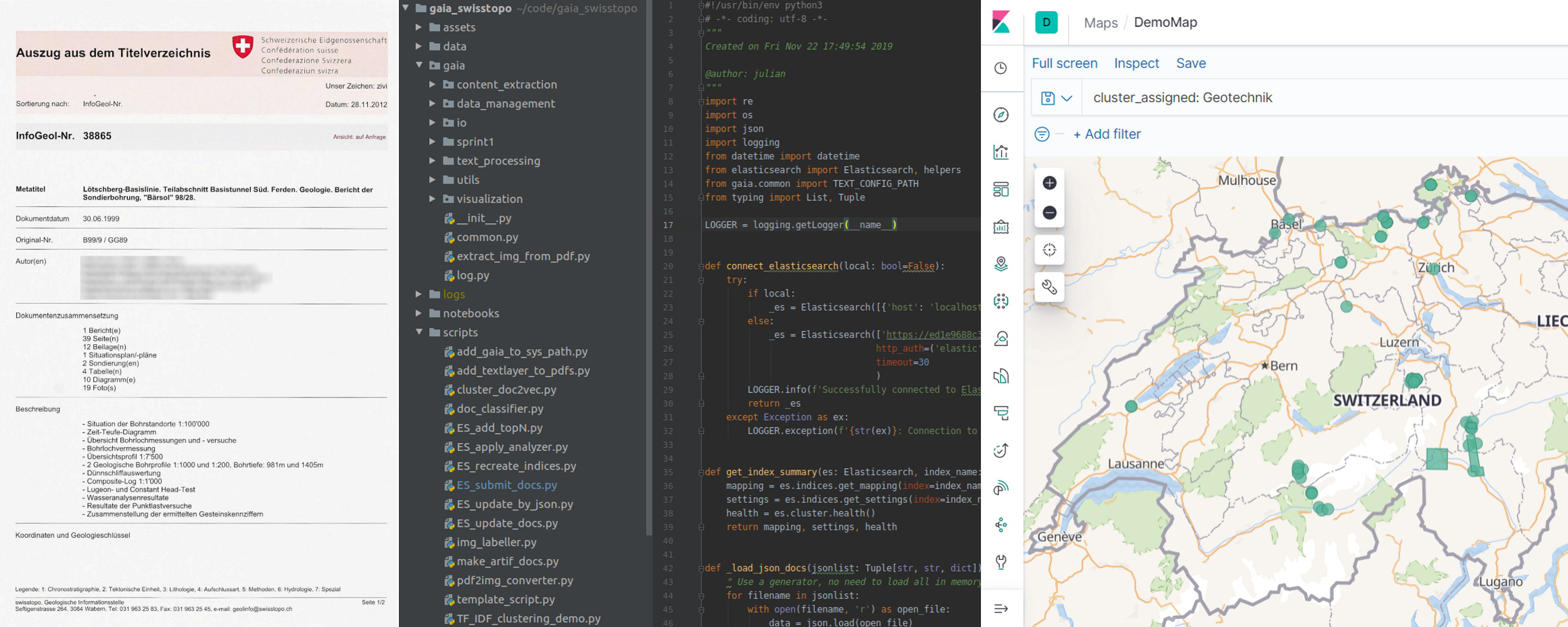
We have focused on existing geoscientific data from the Swiss Geological Survey. There is already a large inventory of geological reports and data, which are mainly archived as PDF documents and contain essential information about the Swiss subsurface. We therefore concentrated on the targeted retrieval and extraction of information from these reports. Based on the existing and constantly growing archive inventory, we have built a workflow tailored to the retrieval of geological terms. In this process, semantically similar reports are classified into geoscientific classes using Natural Language Processing methods. In parallel, geological elements such as borehole profiles, maps and images are automatically identified and extracted using Computer Vision methods and can thus be stored separately for further digitisation and processing [Morgenthaler et al. 2022] (Fig 1).
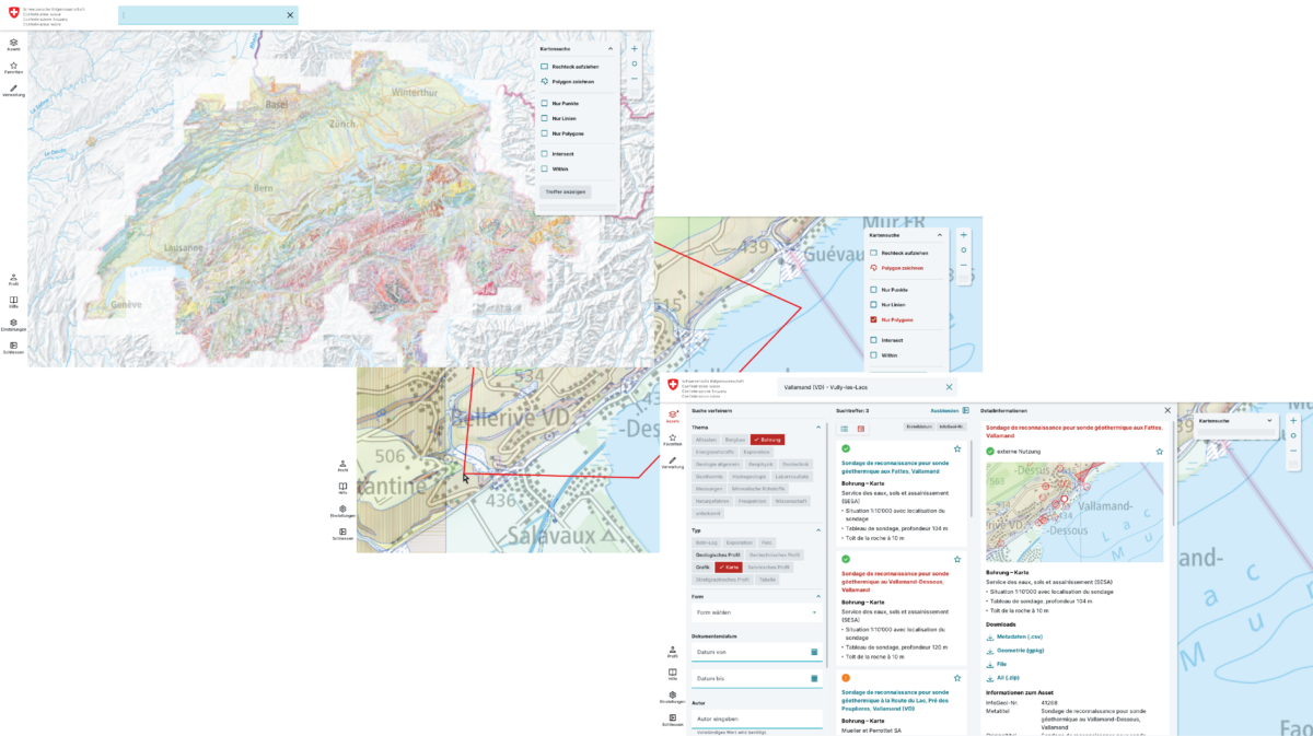
We were also working on making the archives of the Swiss Geological Survey accessible to the public. For this purpose, we have transferred the archive content to a geodata infrastructure on the cloud and process the archive data with machine learning algorithms. To this end, we have developed and designed a modern search and management platform that allows users to access the entire archive via full-text, map, object or thematic searches (Fig 2).


