We are happy to announce the paper by our team member Lukas Nibourel together with colleagues from the Swiss Geological Survey at swisstopo and from our group.
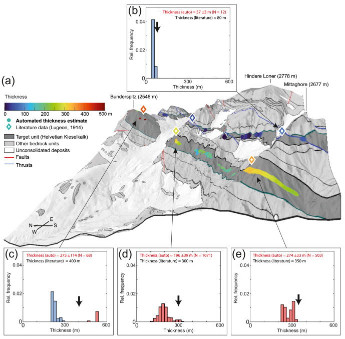
The paper presents an innovative approach to automatically extract orientation (dip direction/dip) and stratigraphic thickness from a 1:25′000 geological map vector data set of the Swiss Alps.
The approach is developed as a part of a mineral resources mapping project funded by swisstopo. It allows a rapid spatial overview on the orientation and thickness of a given geological unit over large areas. It is designed to support authorities and the industry in performing a rapid screening of a given region and to early identify promising areas for potential mineral extraction projects. Large-scale spatial overviews on the orientation and thickness of geological units are of large interest in many other disciplines such as tectonic and stratigraphic reconstruction, hydrogeological or geotechnical analyses.
Nibourel, L., Morgenthaler, J., Grazioli, S., Schumacher, I., Schläfli, S., Galfetti, T. & Heuberger, S. (2023). Automated extraction of orientation and stratigraphic thickness from geological maps. Journal of Structural Geology, 104865.